
|
|
Introduction Spatial analysis using Python with ArcGIS Course
USD 2,400 |

Venue: Nairobi Kenya
Spatial analysis is a fundamental aspect of Geographic Information Systems (GIS), allowing organizations to derive meaningful insights from spatial data. This course is designed to introduce participants to the world of spatial analysis using Python scripting within the ArcGIS environment. Through a combination of theoretical learning and practical exercises, participants will learn how to leverage Python programming for spatial data manipulation, analysis, and visualization. By the end of this course, participants will be equipped with the skills to automate spatial analysis workflows, perform advanced geoprocessing tasks, and develop custom spatial analysis tools using Python with ArcGIS.
Course Objectives:
- Understand the basics of spatial analysis and its applications in GIS.
- Learn how to use Python scripting within the ArcGIS environment for spatial data manipulation and analysis.
- Develop proficiency in performing common spatial analysis tasks, such as buffering, overlay, and spatial statistics, using Python.
- Gain insights into advanced spatial analysis techniques and geoprocessing tools available in ArcGIS.
- Acquire the skills to develop custom spatial analysis tools and workflows using Python scripting.
Organization Benefits:
- Enhanced Data Analysis Capabilities: Participants will learn how to leverage Python scripting to perform advanced spatial analysis tasks, leading to deeper insights and better decision-making for organizations.
- Increased Efficiency: By automating spatial analysis workflows with Python, organizations can save time and resources, resulting in increased productivity and efficiency.
- Customized Solutions: Python scripting allows organizations to develop custom spatial analysis tools tailored to their specific needs and requirements, leading to more effective solutions for spatial data analysis.
- Improved Data Integration: Python scripting facilitates seamless integration of spatial data with other data sources and systems, enabling organizations to unlock the full potential of their data assets.
- Skill Development: By investing in training on Python scripting for spatial analysis with ArcGIS, organizations can enhance the skill set of their workforce, empowering them to tackle complex spatial problems and challenges.
Target Participants:
This course is suitable for GIS analysts, spatial analysts, geospatial professionals, researchers, and anyone interested in learning how to leverage Python scripting for spatial analysis within the ArcGIS environment. Participants should have a basic understanding of GIS concepts and Python programming fundamentals.
Course Outline:
Module 1: Introduction to Spatial Analysis with Python
- Overview of spatial analysis concepts and techniques
- Introduction to Python scripting for GIS
- Setting up Python environment in ArcGIS
Module 2: Working with Spatial Data in Python
- Loading and accessing spatial data using Python
- Data exploration and manipulation with arcpy
- Spatial data formats and conversions
Module 3: Spatial Analysis Techniques I: Geoprocessing Tools
- Introduction to geoprocessing tools in ArcGIS
- Performing common geoprocessing tasks with Python
- Automating workflows with geoprocessing tools
Module 4: Spatial Analysis Techniques II: Spatial Statistics
- Performing spatial statistics analysis using Python
- Exploratory spatial data analysis (ESDA) techniques
- Spatial interpolation and prediction methods
Module 5: Spatial Analysis Techniques III: Network Analysis
- Introduction to network analysis tools in ArcGIS
- Performing network analysis tasks with Python scripting
- Routing and shortest path analysis
Module 6: Spatial Analysis Techniques IV: Geostatistics
- Introduction to geostatistics and variogram analysis
- Spatial prediction and interpolation techniques with Python
- Ordinary kriging and geostatistical modeling
Module 7: Advanced Spatial Analysis Techniques
- Advanced spatial analysis techniques with Python scripting
- Customizing spatial analysis workflows
- Developing custom geoprocessing tools
Module 8: Spatial Data Visualization
- Visualization of spatial data using Python libraries
- Creating custom maps and visualizations
- Interactive spatial data visualization techniques
Module 9: Spatial Data Integration and Management
- Integrating spatial data with other data sources
- Managing spatial data in ArcGIS with Python scripting
- Data quality assurance and validation
Module 10: Applications and Case Studies
- Practical applications of Python scripting for spatial analysis
- Case studies and real-world examples
- Hands-on exercises and projects
| Nairobi Kenya | Dec 02 - 13 Dec, 2024 |
| USD 2,400.00 | (Course fees) |
Amos Mwangi/ Paul Njuguna +254 746 038 012/ +254714541257
Related Courses
 Gender Diversity at the Workplace Course
5 days, 07 - 11 Apr, 2025
Soaring Skills Training Institute Ltd
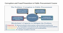 Corruption and Fraud Prevention in Public Procurement Course
5 days, 14 - 18 Apr, 2025
Soaring Skills Training Institute Ltd
 Strategic Project Design and Management Course
5 days, 14 - 18 Apr, 2025
Soaring Skills Training Institute Ltd
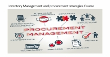 Inventory Management and Procurement Strategies Course
5 days, 14 - 18 Apr, 2025
Soaring Skills Training Institute Ltd
Currency Converter
